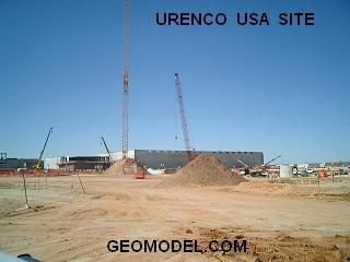
 GeoModel, Inc. completed a nearly three-year utility location contract at the Urenco USA Uranium Enrichment Facility near Eunice, New Mexico. The GeoModel, Inc. contract was for marking utilities in the field and creating 400 as-built utility maps in AutoCAD format for the one square mile facility. These maps were used by the numerous on-site construction companies and facilities management for locating utilities prior to excavation activities.
GeoModel, Inc. used ground penetrating radar (GPR), metal detection, and other locating instruments to map the underground utilities at the Urenco USA site. The GeoModel, Inc. maps were included in the hundreds of construction permits required for excavations at the site.
The pictures below show the type of utilities detected at Urenco USA. They included small PVC pipes, water lines, electrical conduits, fiber optic cables, phone lines, and electric duct banks.


“I look forward to working with GeoModel, Inc. again, says Chris Land of LES.” “I do hope it will be soon.”
Jeremy Neatherlin of Construction, Inc. says, “I worked with GeoModel for about 2 1/2 years at the Urenco USA site and GeoModel was a great benefit to the project.” “GeoModel, Inc. would go above and beyond [the] call of duty.”
“GeoModel is extremely knowledgeable in its field,” says Eileen Simonton, project coordinator for URENCO USA. “GeoModel worked well under pressure and stayed ahead of the schedule. We became very dependent on GeoModel, and I would recommend them to anyone.”
For more information about GeoModel and the services they provide, visit https://geomodel.com, or contact them at https://geomodel.com/contact.