GeoModel

  • Email Us
  • 703-777-9788
  • Home
  • Applications
    • Utility Location
    • Cemetery Mapping and Grave Scanning Services
    • Sinkhole and Void Detection
    • Underground Storage Tank Detection and Buried Drum Detection
    • Geology, Bedrock and Geologic Hazards
    • Landfill Detection, Burial Trench Delineation, and Contaminant Plume Mapping
    • Concrete and Rebar Inspection
    • Archaeological and Environmental Studies
    • Brine Pits, Reserve Pits, Leaking Brine Pipes
    • Locating Ledge
  • Methods
    • What is Ground Penetrating Radar
    • Electromagnetic Conductivity Survey, Terrain Conductivity Survey, and EM Survey
    • Magnetometer Surveys
    • Resistivity or Surface Resistivity
  • Case Studies
  • News
  • Articles
  • About
  • Contact

Locating Ledge

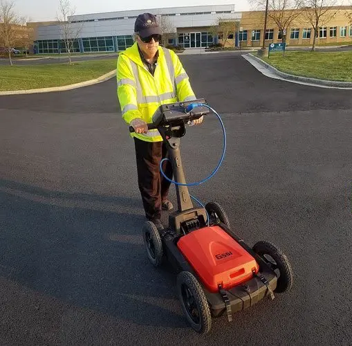
GeoModel, Inc. conducts professional, geologic surveys for locating ledge throughout the United States. Ledge is top of bedrock that is sometimes a problem for construction of buildings, installation of pools, or other land improvement projects.

GeoModel utilizes ground penetrating radar (GPR) for locating ledge on a property. GPR is a non-destructive geophysical method that is one of the best methods for locating ledge.
 

A photograph of exposed bedrock ledge is shown below. Because the depth to the top of the bedrock ledge on other parts of the property is unknown, a GPR survey will be conducted to locate the depth to the top of bedrock ledge.

Exposed Bedrock Ledge


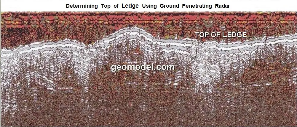
GeoModel, Inc. can locate depth to top of ledge for individual transect lines at a site or for an entire area of a property. Here are individual ground penetrating radar (GPR) images of GeoModel, Inc. locating ledge at different properties.

This GPR image shows the undulating surface of rock ledge underlying a sandy soil.
Below is a GPR image of a sloping ledge at a depth of 5 feet at the beginning (left edge) of the image to a depth of over 8 feet at the end (right edge) of the image.

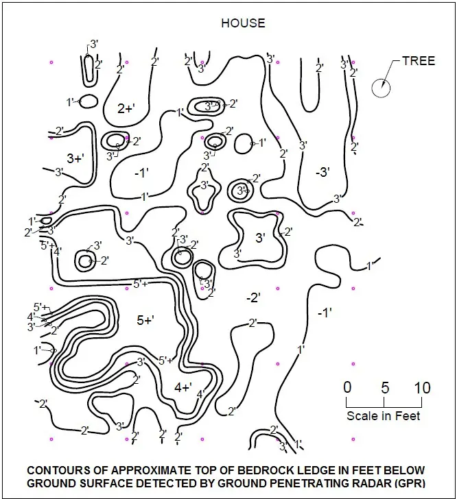
If GeoModel, Inc. scans a specific area of property for locating bedrock ledge, then we can provide a contour map of the top of ledge, as shown below:
GeoModel

All GPR surveys are conducted or supervised by:

  • Certified Professional Geologists with More Than 20 Years of Experience
  • 40-Hour OSHA Hazwoper-Trained Professionals
  • Operators using FCC-approved Equipment
  • Field crews available nationwide
  • Woman-Owned Small Business (WBE)

Quicklinks

  • What is Ground Penetrating Radar
  • Utility Location
  • Cemetery and Grave Location and Mapping
  • Sinkhole and Void Detection
  • Underground Storage Tank Detection and Buried Drum Detection
  • Geology, Bedrock and Geologic Hazards
  • Landfill Detection, Burial Trench Delineation, and Contaminant Plume Mapping
  • Concrete and Rebar Inspection
  • Archaeological and Environmental Studies
  • Brine Pits, Reserve Pits, Leaking Brine Pipes
  • Locating Ledge

Connect With Us

Email Us
703-777-9788
  • Facebook
  • LinkedIn
© Copyright 2026 GeoModel, Inc. All Rights Reserved · Small Business Websites by Digital Fern · Admin
▲