GeoModel

  • Email Us
  • 703-777-9788
  • Home
  • Applications
    • Utility Location
    • Cemetery Mapping and Grave Scanning Services
    • Sinkhole and Void Detection
    • Underground Storage Tank Detection and Buried Drum Detection
    • Geology, Bedrock and Geologic Hazards
    • Landfill Detection, Burial Trench Delineation, and Contaminant Plume Mapping
    • Concrete and Rebar Inspection
    • Archaeological and Environmental Studies
    • Brine Pits, Reserve Pits, Leaking Brine Pipes
  • Methods
    • What is Ground Penetrating Radar
    • Electromagnetic Conductivity Survey, Terrain Conductivity Survey, and EM Survey
    • Magnetometer Surveys
    • Resistivity or Surface Resistivity
  • Case Studies
  • News
  • Articles
  • About
  • Contact

Archaeological and Environmental Studies

GeoModel, Inc. conducts archaeological site studies and environmental impact mitigation surveys using ground penetrating radar (GPR) and electromagnetic conductivity (EM). The types of archaeological features that can be investigated include:

  • Burial Trenches
  • Old, Buried Foundations and Walls
  • Burial Mounds and Graves
  • Covered-Over Historic Roads
  • Buried Metal Relics
  • Brownfield Sites
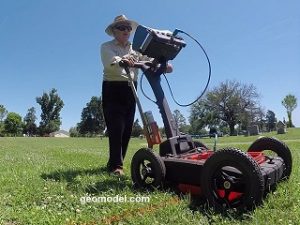
GeoModel, Inc. Professional with GPR Cart
GPR Image of Two Burial Trenches

GeoModel, Inc. has conducted ground penetrating radar (GPR) surveys at various archaeological sites nationwide.  The ground penetrating radar surveys identified areas of archaeological concern, and the archaeologists, from other companies, prepared and dug the areas delineated by the GeoModel, Inc. GPR survey.

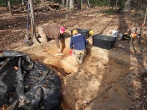
Pre-Historic Rock Quarry
Buried Foundations and Walls Site

GeoModel, Inc. conducted a ground penetrating radar (GPR) survey in Port Royal, Jamaica, to investigate historical, covered-over roads, walls, and foundations.  Matthew Turner, PG, gave a presentation about the GPR survey and results of the survey for the Archaeological Division of Port Royal, Jamaica.

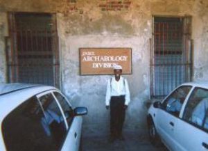
Jamaican Archaeological Division
Matt Turner, PG, Discussing GPR Survey

GeoModel

All GPR surveys are conducted or supervised by:

  • Certified Professional Geologists with More Than 20 Years of Experience
  • 40-Hour OSHA Hazwoper-Trained Professionals
  • Operators using FCC-approved Equipment
  • Field crews available nationwide
  • Woman-Owned Small Business (WBE)

Quicklinks

  • What is Ground Penetrating Radar
  • Utility Location
  • Cemetery and Grave Location and Mapping
  • Sinkhole and Void Detection
  • Underground Storage Tank Detection and Buried Drum Detection
  • Geology, Bedrock and Geologic Hazards
  • Landfill Detection, Burial Trench Delineation, and Contaminant Plume Mapping
  • Concrete and Rebar Inspection
  • Archaeological and Environmental Studies
  • Brine Pits, Reserve Pits, Leaking Brine Pipes

Connect With Us

Email Us
703-777-9788
  • Facebook
  • LinkedIn
© Copyright 2014 GeoModel, Inc. All Rights Reserved · Small Business Websites by Digital Fern · Admin
▲